Being a glacial archaeologist is a great job. Once we are on the ice sites and discover fantastic finds, it is hard to beat. However, don’t forget that the first job is finding those glacial archaeological sites. This is more challenging than it may sound. Why not just hike up there and start checking along the edge of the melting ice? Well, the thing is that here in Innlandet County alone, there are 10000 km2 of high mountain terrain with hundreds of glaciers and ice patches. Some of these ice masses may have finds, while other may not. Where to start? That was what we were wondering back in 2006, when the first big melt hit our high mountains.
Glacial ice and the preservation of artefacts
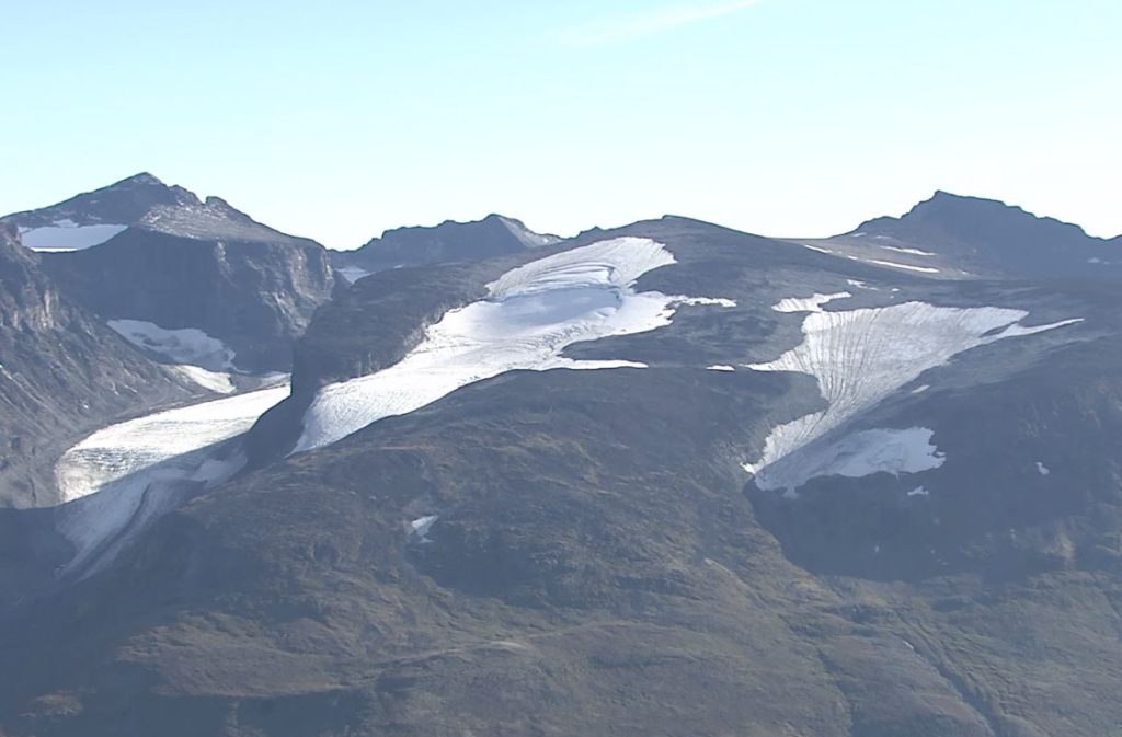
The hunt for glacial archaeological sites begins by understanding that not all high mountain ice preserves artefacts for thousands of years. If you want to find artefacts, ice patches or other types of non-moving mountain ice is the place to look. Big, sliding glaciers that crunch their way down rock slopes is no good for the survival of fragile artefacts (read about ice patches and glaciers as archaeological find spots here). So, job no. 1 is to locate the non-moving ice – that’s where the ancient artefacts may be found (if one is lucky). But how can we find this type of ice?
Exploring maps and remote sensing
Work starts by first looking for ice in general on maps, aerial photos, and satellite imagery. Large ice masses are found on maps, while smaller ones may not be shown. One of our most find rich sites, a small ice patch with more than 200 finds, was not on any map. So, checking both maps and aerial imagery is a good idea. Google Earth is a great tool. You can see the ice in 3D in different years. Still, it can be hard to be sure whether the ice masses in your inventory of mountain ice are moving or not just based on the available photos. What if the ice is covered in snow, so you cannot see the crevasses – a tell-tale sign of ice movement?
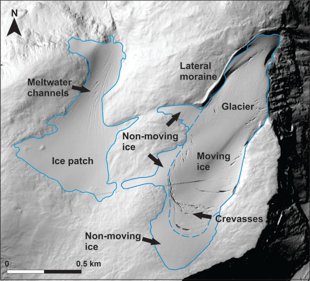
We have a great tool to help solve this problem in Innlandet County – a very detailed digital terrain model available through the internet. This model shows us which areas have ice (smooth in contrast to the uneven rock surface) and which ones of the ice masses are not moving much (the ones without crevasses). This has helped us to cut back on the number of potential sites. However, the number of ice masses that need checking is still high, and funding is limited.
Computer modelling
Glacial archaeologists try to use computer modelling to narrow down the search. To locate where ancient trails crossed ice, archaeologists can ask computer programs for help. The programs can calculate where the easiest route from A to B would have gone, taking the terrain into consideration. With all the rough mountain ground, the even ground of snow-covered ice could have been a convenient highway for ancient travelers (except if you fall into a crevasse and die (read more here)). One such analysis in our Jotunheimen Mountains showed several such routes, but they crossed large, artefact-crushing glaciers. However, the potential is clearly there. The type of approach is quite common in the Alps where most of the finds are connected to high altitude traveling.
Local knowledge
Even with all the maps and computer modelling, finding the actual sites is still a daunting task, due to the many possible locations. Seeking knowledge from local mountain hikers, reindeer shepherds and wildlife researchers can be a great help to focus the search.
If a hiker finds artefacts at an ice patch and reports it to us, we already have a glacial archaeological site and know where we can direct fieldwork. Even a report of hunting blinds (stone-built walls to hide hunters from view) or other ancient monuments close to an ice mass will raise our attention about a possible site.
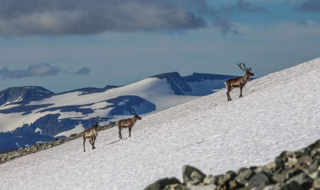
Today, reindeer seek out ice and snow on hot days in July and August to avoid pestering botflies, just as they did in the past. Some ice masses are more popular than others among the reindeer. This probably has to do with the distance between good grazing grounds and the ice, and how accessible the ice is. We can learn about which ice masses are the most popular among the reindeer today by talking to reindeer researchers and shepherds. This narrows down the search even further.
How many potential sites are we talking about?
Combining of all the methods above, we have been able to cut down the number of potential, but unvisited glacial archaeological sites to 151. That is still a high number. However, it was even higher before we started checking the potential sites in the field (see below). We now have 64 archaeological ice sites confirmed in the field. Only 16 ice masses have been visited without the discovery of artefacts. And those 16 sites generally had a lot of snow at the time of visit. This means that they may be “sleeping” sites which may not reveal themselves as sites until the ice starts to melt more. But how do we check out the potential sites? This is when boots on the ground are needed.
Exploratory surveys
With the deskwork behind us, time has come to check out possible sites in the field. These exploratory surveys cannot start before August each year. We need the winter snow from the previous year to have melted away first. With the threat of new winter snow looming (usually in late September), the time window for high mountain fieldwork is limited to weeks.
An exploratory survey is typically a one-day hike up to a potential site with a crew of max. three people. It entails scaling a lot of elevation, so we travel light and carry a minimum of equipment. Once up at the ice, we spread out and conduct search lines near the ice. The basic job is to find out if there are artefacts present or not. We also look for bones and antlers as they show that the ice preserves organic material.
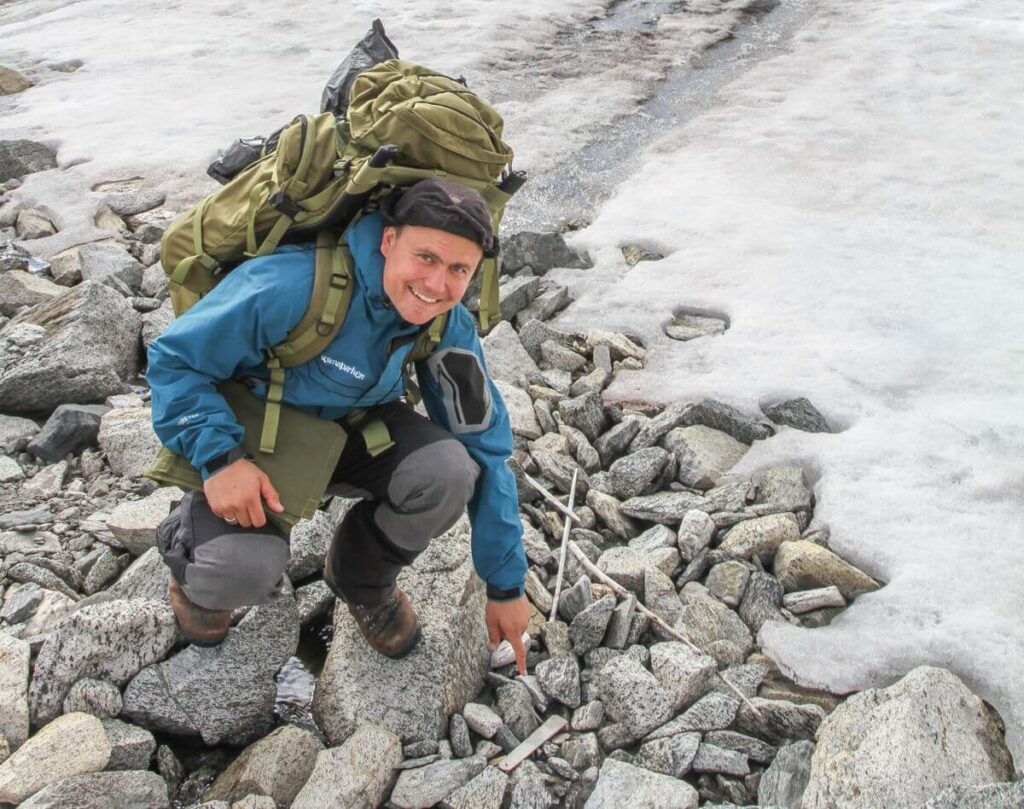
Once artefacts are discovered, things tend to get a bit hectic. Time is limited and we need to get the job done and get off the mountain before nightfall. How many finds are there and how is their preservation? If it is a small site with just a handful of finds, we will document and collect those. On larger sites, we sample the finds and may also collect fragile finds that do not look they like will survive until the next visit.
If it is a site with many finds, we check the surroundings to look for a good spot to set up a basecamp. We need to come back to the site again for a large-scale systematic survey. This survey will be with a larger crew, for a longer period and with much more equipment. This is a completely different ballgame (read on here).